United States of America Antique North America Nautical Maps
151 Results
Rare Map of the Mouth of the Columbia River 1851
$30.000 bids$6.50 shippingEnding Friday at 9:30PM PDT4d 11hOriginal 1853 REEDY ISLAND Ice Harbor Construction Diagram Delaware River Piers
$14.99$4.59 shippingOriginal 1851 Coast Survey Chart North Carolina Outer Banks
$250.00$14.10 shipping1943 Vintage Map - New York to Newport 1776-1783 - Rhode Island - New York City
$13.00$5.00 shippingHAWAII HAWAIIAN NATIVE WOMAN UNITED STATES 1785 COOK ANTIQUE ORIGINAL PORTRAIT
ANTIQUE COPPER ENGRAVED PORTRAIT HAWAIIAN NATIVE WOMAN$9.990 bids$25.00 shippingEnding May 20 at 10:29PM PDT7d 12h1851 U S Coast Survey Map,Savannah & 2 Rivers,Approaches,Islands,Soundings,Tides
$12.95$4.95 shippingNautical Chart 152-SC Galveston Bay To Freeport Texas 1965
$39.99$5.13 shippingOriginal 1881 Survey Map MOUTH OF THE COLUMBIA RIVER Oregon Soundings Breakers
$24.99$4.69 shippingAntique 1784 Nautical Chart Cook Inlet Prince William Sound Alaska Original Map
Anchorage Kenai Peninsula Cap.James Cook NW Exploration$175.00$20.23 shipping1851 U S Coast Survey Map,Sandy Hook,NJ,1779-1851,Coves,Lighthouse,changes,Head
$14.95$4.95 shipping1853 Gunnison Survey Map FOR NEW CHANNEL FROM MILWAUKEE RIVER TO LAKE MICHIGAN
$39.99$4.59 shipping1916 antique ELDRIDGE MAP linen backed GLOUCESTER to KENNEBEC RIVER 24.5"x67"
$495.00$27.75 shippingOriginal 1861 Coast Survey Shipwreck Map COOS BAY Oregon Soundings Tide Table
$49.99$6.00 shipping1960 Vintage Nautical Map Atlantic City to Cape May NJ Shore C.&G.S. 38”x24
$75.00$19.20 shippingALASKA, BRITISH COLUMBIA, U.S. WEST COAST, 1877 ADMIRALTY SEA CHART. No. 787
$36.27$24.49 shippingOriginal 1855 Coast Survey Chart North Carolina Albemarle Sound Hand Colored
$400.00$14.10 shippingVintage 1929 Coast Guard Nautical Map Galveston to Mississippi River 36 x 44"
$20.00Was: $22.22Free shipping1851 US Coast Survey Map of Mouth of Columbia,California,soundings,other rivers
$29.95$5.95 shippingVINTAGE ADMIRALTY CHART. No.2489. NANTUCKET SOUND, E. APPROACHES. 1958 Edition.
$61.29$25.02 shipping1854 Gloucester Cape Ann American Coast Pilot Massachusetts MA USA Antique Map
$49.99$20.00 shippingVINTAGE ADMIRALTY CHART. No.2456. NANTUCKET SOUND, W. APPROACHES. 1946 Edition.
$61.29$25.02 shipping1851 US Coast Survey Map,Point Pinos,Monterey Bay,Califirnia,proposed Lighthouse
$19.95$4.45 shippingNautical Map of West End of Lake Erie for traning purpose only
$14.99Free shippingAntique Early 1900’s New York Bay & Harbor Maritime Maps
$95.00$10.75 shippingOriginal 1863 US Coast Survey Map HALF MOON BAY California Whaling Stations
$69.99$4.69 shippingVINTAGE ADMIRALTY CHART. No.2530. SAN FRANCISCO, SAN DIEGO, L. A. 1928 Edition.
$73.79$20.01 shippingVINTAGE ADMIRALTY CHART. No. 266. BARNEGAT INLET to ALBEMARLE SOUND. 1923 EdN.
$61.29$20.01 shippingVintage Tampa Bay And St. Joseph Sound NOAA 1972 Nautical Map Number 1257
$119.00$15.56 shipping1860 U.S.C.S.Nautical Chart MONOMOY NANTUCKET SHOAL BLOCK ISLAND-1874 CORRECTION
$299.49$20.00 shippingVINTAGE ADMIRALTY CHART. No.975. GALVESTON BAY to CALCASIEU PASS 1954 Edn.
$48.78$25.02 shipping2 Antique maps 1907 Chesapeake Md shellfish coast survey Somerset Wicomico
$25.00$9.90 shippingVINTAGE ADMIRALTY CHART. No. 2866. CAPE CANAVERAL to KEY WEST. 1962
$30.02$27.33 shipping1977 Sea Chart Cape Cod Massachusetts USA Vintage Original Map Coastal Sailing
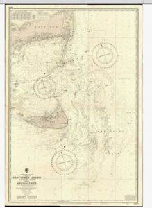
$24.99$25.00 shippingVINTAGE ADMIRALTY CHART. No.2563. DELAWARE RIVER APPROACHES. 1961 Edition.
$61.29$25.02 shipping1967 FLORIDA AND BAHAMAS Operational Nav Chart HUGE Map ONC H-25 - 41"x57"
$36.50$4.95 shippingVINTAGE ADMIRALTY CHART. No.2856. CHESAPEAKE BAY, COVE POINT. 1944 Edition.
$61.29$20.01 shippingRARE Antique HC with 38 MAPS U.S. Coast Survey for 1852
$650.00$18.40 shippingNewport California Chart #5108 1967 10th Ed
$20.00$17.40 shippingVINTAGE ADMIRALTY CHART. No.1499. KODIAK ISLAND, ALASKA. 1934 Edition.
$61.29$25.02 shippingVINTAGE ADMIRALTY CHART. No. 2489. MASSACHUSETTS. NANTUCKET SOUND. 1955.
$61.29$25.02 shippingLot Of 3 Lake Michigan Maps NOAA Charts
$20.00$5.00 shipping1928 Costal Color Tidal Current Chart,New York Harbor Staten Coney Long Island
$99.99$4.99 shippingOriginal 1863 Coast Survey Chart Map ROCKLAND HARBOR & VICINITY Maine Lighthouse
$69.99$6.00 shippingANTIQUE ADMIRALTY CHART. No.3382. MISSISSIPPI RIVER, NEW ORLEANS. 1917 Edition.
$61.29$20.01 shippingOLD South West Pacific Mercators Projection Map Librairie Pentecost Noumea 1900s
$20.00$5.99 shippingOriginal 1853 Coast Survey Soundings Map CORTES BANK California Channel Islands
$39.99$4.69 shippingANTIQUE ADMIRALTY CHART. No.269. FLORIDA, JACKSONVILLE, CAPE CANAVERAL. 1886 Edn
$61.29$25.02 shippingVINTAGE ADMIRALTY CHART. No.3380. Plans in the GULF of MEXICO, 1954.
$61.29$25.02 shippingNew Listing1957 CAPE COD BAY NAUTICAL CHART BY UNITED STATES COASTAL & GEODITIC # 1200
$88.000 bidsEnding May 19 at 4:38PM PDT6d 6h$7.75 shipping1960s Lake Erie Educational Map For Training Purposes Only
$25.00$12.00 shippingVintage SEACRAFT MAP Framed Glass Tray San Juan Islands Brass Cleat Handles
$75.00$30.25 shippingOriginal 1853 Coast Survey Soundings Map HORN ISLAND PASS Pascagoula Mississippi
$49.99$4.69 shippingANTIQUE ADMIRALTY CHART. No. 2818. VIRGINIA. JAMES RIVER. 1892
$61.29$20.01 shippingVintage Copy U.S. Coast Survey Reconnaissance of Port Townshend WA. Map/Chart
$34.99$6.33 shippingVINTAGE ADMIRALTY CHART. No. 2457. LONG ISLAND SOUND. 1856.
$61.29$25.02 shipping1851 U S Coast Survey Map E,2,Savannah,River,Islands,survey progress lines,scale
$14.95$4.95 shippingUS COAST SURVEY MAP 1854 Washington Smith's Island
$15.00$10.00 shippingOriginal 1861 Coast Survey Map COQUILLE RIVER Oregon Pacific Ocean Compass Rose
$49.99$6.00 shipping